
Mapa topográfico Lac de Gaube
Mapa interativo
Clique no mapa para exibir a altitude.
Lac de Gaube
The lake is situated in an altitude of 1725 m, an egg-shaped form stretching itself along a north–south axis in the valley of Gaube. This steep-sided valley is located at the foot of the Vignemale (3298M). The lake is surrounded by the peak Mayouret (2688 m) to the east, the big Peak of the Paloumères (2720 m) to the southeast, and the peak of Gaube (2377 m) to the northwest.
Sobre este mapa
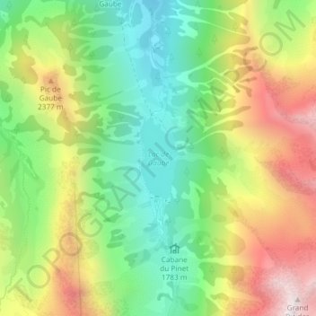
Nome: Mapa topográfico Lac de Gaube, altitude, relevo.
Altitude média: 2079 m
Altitude mínima: 1642 m
Altitude máxima: 2689 m
Outros mapas topográficos
Clique em um mapa para visualizar sua topografia, sua altitude e seu relevo.
Vue sur Cascades et Pont d'Espagne
France > Occitania > Hautes Pyrenees > Cauterets
Altitude média: 1827 m