
Mapa topográfico Thenzawl
Mapa interativo
Clique no mapa para exibir a altitude.
Sobre este mapa
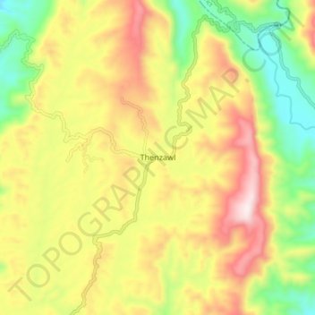
Nome: Mapa topográfico Thenzawl, altitude, relevo.
Local: Thenzawl, Serchhip, Serchhip District, Mizoram, 796186, India (23.24128 92.73534 23.32128 92.81534)
Altitude média: 738 m
Altitude mínima: 408 m
Altitude máxima: 1101 m