
Mapa topográfico Ban Nong Chaeng
Mapa interativo
Clique no mapa para exibir a altitude.
Sobre este mapa
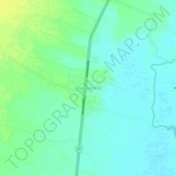
Nome: Mapa topográfico Ban Nong Chaeng, altitude, relevo.
Local: Ban Nong Chaeng, Ban Phot, Phetchabun Province, Thailand (15.83841 100.99241 15.87841 101.03241)
Altitude média: 84 m
Altitude mínima: 77 m
Altitude máxima: 98 m
Outros mapas topográficos
Clique em um mapa para visualizar sua topografia, sua altitude e seu relevo.
Wang Pong
Thailand > Phetchabun Province
Wang Pong, Phetchabun Province, Thailand
Altitude média: 117 m
Phetchabun
Thailand > Phetchabun Province
Phetchabun, Phetchabun Province, 67000, Thailand
Altitude média: 120 m