
Mapa topográfico Ngwathe Ward 13
Mapa interativo
Clique no mapa para exibir a altitude.
Sobre este mapa
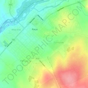
Nome: Mapa topográfico Ngwathe Ward 13, altitude, relevo.
Altitude média: 1407 m
Altitude mínima: 1366 m
Altitude máxima: 1467 m
Outros mapas topográficos
Clique em um mapa para visualizar sua topografia, sua altitude e seu relevo.
Ngwathe Ward 18
RSA > Free State > Ngwathe Local Municipality
Ngwathe Ward 18, Ngwathe Local Municipality, Fezile Dabi District Municipality, Free State, RSA
Altitude média: 1443 m