
Faça uma doação
Prepare-se para a sua próxima aventura:
Como Associado da Amazon, este site recebe uma comissão sobre compras elegíveis sem custo adicional para si.
Mapa topográfico Florida Keys
Clique no mapa para exibir a altitude.
Faça uma doação
Prepare-se para a sua próxima aventura:
Como Associado da Amazon, este site recebe uma comissão sobre compras elegíveis sem custo adicional para si.
Florida Keys
Tropical cyclones present special dangers and challenges to the entire Keys. Because no area of the islands is more than 20 feet (6.1 m) above sea level (and many are only a few feet elevation), and water surrounds the islands, nearly every neighborhood is subject to flooding as well as hurricane winds. In response, many homes in the Keys are built on concrete stilts with the first floor being not legally habitable and enclosed by breakaway walls that are not strongly attached to the rest of the house. Nonetheless, Monroe County, as reported in the Federal Register, has estimated that there are between 8,000 and 12,000 illegal enclosures inhabited by people.
Faça uma doação
Prepare-se para a sua próxima aventura:
Como Associado da Amazon, este site recebe uma comissão sobre compras elegíveis sem custo adicional para si.
Sobre este mapa
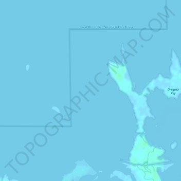
Nome: Mapa topográfico Florida Keys, altitude, relevo.
Local: Florida Keys, Monroe County, Florida, United States (24.66704 -81.58319 24.66714 -81.58309)
Altitude média: 0 m
Altitude mínima: -2 m
Altitude máxima: 5 m
Faça uma doação
Prepare-se para a sua próxima aventura:
Como Associado da Amazon, este site recebe uma comissão sobre compras elegíveis sem custo adicional para si.
Outros mapas topográficos
Clique em um mapa para visualizar sua topografia, sua altitude e seu relevo.