
Mapa topográfico Darreh Shahr
Mapa interativo
Clique no mapa para exibir a altitude.
Sobre este mapa
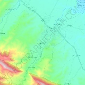
Nome: Mapa topográfico Darreh Shahr, altitude, relevo.
Altitude média: 734 m
Altitude mínima: 554 m
Altitude máxima: 1324 m
The elevation of the town varies from 635 m (2,083 ft) in the northeast to 695 m (2,280 ft) in the southwest areas which are closer to the mountains.