
Mapa topográfico Cherrapunji (Sohra)
Mapa interativo
Clique no mapa para exibir a altitude.
Sobre este mapa
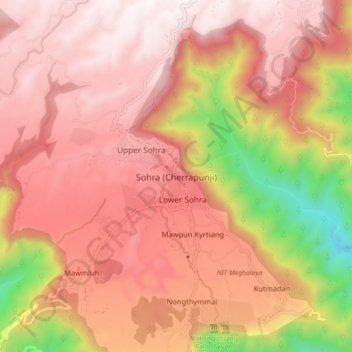
Nome: Mapa topográfico Cherrapunji (Sohra), altitude, relevo.
Altitude média: 1248 m
Altitude mínima: 332 m
Altitude máxima: 1677 m
It has an average elevation of 1,430 metres (4,690 ft) and sits on a plateau in the southern part of the Khasi Hills, facing the plains of Bangladesh. The plateau rises 660 meters above the surrounding valleys.