
Mapa topográfico Allegheny Portage Railroad National Historic Site
Mapa interativo
Clique no mapa para exibir a altitude.
Sobre este mapa
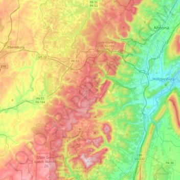
Nome: Mapa topográfico Allegheny Portage Railroad National Historic Site, altitude, relevo.
Altitude média: 570 m
Altitude mínima: 280 m
Altitude máxima: 957 m
A skew arch bridge, a masterwork of cut stone construction, is another feature of the site near the Lemon House. The bridge is 60.4 feet (18.4 m) long on the south elevation, 54.9 feet (16.7 m) long on the north elevation, and 22.2 feet (6.8 m) high. It was the only bridge on the line that was built to carry a road.