

Mapa topográfico Kashmir
Clique no mapa para exibir a altitude.
Sobre este mapa

Nome: Mapa topográfico Kashmir, altitude, relevo.
Local: Kashmir, India (32.27636 72.50883 37.08411 80.42172)
Altitude média: 3595 m
Altitude mínima: 175 m
Altitude máxima: 7883 m
Outros mapas topográficos
Clique em um mapa para visualizar sua topografia, sua altitude e seu relevo.

Siliguri
India > West Bengal > Matigara block
Siliguri located at the foothills of the eastern Himalayas at a location of 26°43′N 88°26′E / 26.71°N 88.43°E / 26.71; 88.43. This city is spread over an area of 260 km2 within the Siliguri Corridor, also known as the Chicken's neck. The city is surrounded by dense forests towards north and…
Altitude média: 121 m
Bhubaneshwar
India > Odisha > Bhubaneswar (M.Corp.)
Bhubaneswar is in Khordha district of Odisha. It is in the eastern coastal plains, along the axis of the Eastern Ghats mountains. The city has an average altitude of 45 m (148 ft) above sea level. It lies southwest of the Mahanadi River that forms the northern boundary of Bhubaneswar metropolitan area, within…
Altitude média: 30 m

Western Ghats
The range starts near south of the Tapti river and runs approximately 1,600 km (990 mi) through the states of Gujarat, Maharashtra, Karnataka, Goa, Kerala and Tamil Nadu ending at Marunthuvazh Malai, Swamithope near the southern tip of India. These hills cover 160,000 km2 (62,000 sq mi) and form the catchment…
Altitude média: 2225 m
Dehradun
India > Uttarakhand > Dehradun
The city of Dehradun mainly lies in Doon Valley and is at a varying height from 410 m (1,350 ft) in Clement Town to above 700 m (2,300 ft) at Malsi which is 15 km (9.3 mi) from the city. However, the average elevation is 450 m (1,480 ft) above sea level. Malsi is the starting point of Lesser Himalayan Range…
Altitude média: 904 m
Bengaluru
India > Karnataka > Bangalore North
Bengaluru lies in the southeast of the South Indian state of Karnataka in the heart of the Mysore Plateau (a region of the larger Deccan Plateau) at an average elevation of 900 m (2,953 ft). The city covers an area of 741 km2 (286 sq mi). The Bengaluru metropolitan region covers an area of 7,005 km2 (2,705 sq…
Altitude média: 879 m
Maharashtra
Maharashtra is the third largest state by area in India. The Western Ghats better known as Sahyadri, are a hilly range running parallel to the coast, at an average elevation of 1,200 metres (4,000 ft). Kalsubai, a peak in the Sahyadris, near Nashik city is the highest elevated point in Maharashtra. To the west…
Altitude média: 478 m
Panvel
India > Maharashtra > Panvel > Panvel
Matheran is a hill station and a municipal council in the Raigad district in the Indian state of Maharashtra. It is a hill station in Karjat Tahsil and is also the smallest hill station in India. It is located on the Western Ghats range at an elevation of around 800 m (2,625 feet) above sea level. It is…
Altitude média: 75 m




Daulat Beg Oldi
Daulat Beg Oldi (DBO) lies at the northeastern corner of the Karakoram Range, at the northern edge of Depsang Plains at an elevation of 5,100 metres (16,700 ft). The international border with China is 8 km to the north and the Line of Actual Control with Chinese-controlled Aksai Chin is 9 km to the east. Other…
Altitude média: 5085 m

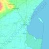
Kakinada
India > Andhra Pradesh > Kakinada (Urban)
Kakinada is located at 16°56′N 82°13′E / 16.93°N 82.22°E / 16.93; 82.22. The 82-degrees east longitude passes through the city. It has an average elevation of 2 metres (6 ft), and many areas of the city are below sea level.
Altitude média: 7 m


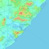
Visakhapatnam
India > Andhra Pradesh > Visakhapatnam Urban
The city is situated between the Eastern Ghats and the Bay of Bengal. The city coordinates lies between 17.7041 N and 83.2977 E. The city's area is 682 km2. The average elevation is 45 metres. Visakhpatnam is situated in Coastal Andhra Region.
Altitude média: 35 m


Coastal & Marine Biodiversity Centre
India > Maharashtra > Thane Subdistrict > Navi Mumbai
Altitude média: 4 m

Manimuthar River
India > Tamil Nadu > Nanguneri
With elevations ranging from 1,020–1,500 metres (3,350–4,920 ft), the Manjolai area is set deep in the Western Ghats within the Kalakkad Mundanthurai Tiger Reserve in Tirunelveli District. Located on top of the Manimuthar Dam and the Manimuthar waterfalls, the Manjolai area comprises tea plantations and…
Altitude média: 604 m


Mumbai
Mumbai lies at the mouth of the Ulhas River on the western coast of India, in the coastal region known as the Konkan. It sits on Salsette Island (Sashti Island), which it partially shares with the Thane district. Mumbai is bounded by the Arabian Sea to the west. Many parts of the city lie just above sea level,…
Altitude média: 13 m





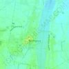
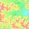






Sultan Bathery
India > Kerala > Sulthanbathery
Sulthan Bathery is located at 11°40′N 76°17′E / 11.67°N 76.28°E / 11.67; 76.28. It has an average elevation of 907 m (2,976 ft).
Altitude média: 876 m

Vijayawada
India > Andhra Pradesh > Vijayawada (Urban)
Vijayawada lies on the banks of Krishna river, covered by hills and canals. and at an altitude of 11 m (36 ft) above sea level. Three canals originating from the north side of the Prakasam Barrage reservoir — Eluru, Bandar, and Ryves — flow through the city.
Altitude média: 37 m


Rapar
India > Gujarat > Rapar Taluka
Rapar (earlier known as Rahpar) is located at 23°34′N 70°38′E / 23.57°N 70.63°E / 23.57; 70.63. It has an average elevation of 79 metres (259 feet). Rapar is the main town in the Vagad Region of the Kutch District and the easternmost town of the Kutch District.
Altitude média: 68 m

Kadiri
India > Andhra Pradesh > Kadiri
Kadiri is located at 78.170 degrees E longitude and 14.120 degrees N latitude and has an average elevation of 504.00 meters (1653 feet) above MSL. Kadiri is surrounded by hill on the north and east.
Altitude média: 550 m


Kashmir Valley
India > Jammu and Kashmir > Srīnagar > Shalteng
The Kashmir Valley lies between latitude 33° and 35°N, and longitude 73° and 76°E. The valley is 100 km (62 mi) wide and covers 15,520.3 km2 (5,992.4 sq mi) in area. It is bounded by sub-ranges of the Western Himalayas: the Great Himalayas bound it in the northeast and separate it from the Tibetan Plateau,…
Altitude média: 1585 m




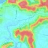


Dakshina Kannada
The topography of the district is plain up to 30 km (18.64 mi) inside the coast and changes to undulating hilly terrain sharply towards the east in the Western Ghats. Teak, bamboo and rosewood trees are found in the hilly areas towards the east. The Geological Survey of India has identified this district as a…
Altitude média: 109 m
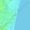
Chennai
Chennai is located on the south–eastern coast of India in the north–eastern part of Tamil Nadu on a flat coastal plain known as the Eastern Coastal Plains. Its average elevation is around 6.7 metres (22 ft), and its highest point is 60 m (200 ft). Chennai is 2,184 kilometres (1,357 mi) south of Delhi,…
Altitude média: 7 m


Coonoor
India > Tamil Nadu > Coonoor
Coonoor is located at 11°20′42″N 76°47′42″E / 11.345°N 76.795°E / 11.345; 76.795. It has an average elevation of 1,650 metres (5413 feet) above sea level. It features a sub-tropical highland climate (Koppen;Cfb) due to high altitude.
Altitude média: 1764 m

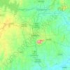
Mysuru
India > Karnataka > Mysuru taluk
Mysore (/maɪˈsɔːr/ (listen)), officially Mysuru ([ˈmaɪˈsuːɾu] (listen)), is a city in the southern part of the state of Karnataka, India. Mysore city is geographically located between 12° 18′ 26″ north latitude and 76° 38′ 59″ east longitude. It is located at an altitude of 770 m (2,530 ft)…
Altitude média: 727 m
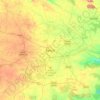
Ranchi
Ranchi lies at 23°22′N 85°20′E / 23.36°N 85.33°E / 23.36; 85.33 near to the Tropic of Cancer. The city covers an area of 175 km2 (68 sq mi) and its average elevation is 651 m above sea level. Ranchi is located in the southern part of the Chota Nagpur plateau, which is the eastern section of…
Altitude média: 648 m
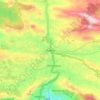
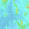
Navi Mumbai
India > Maharashtra > Thane > Navi Mumbai
Navi Mumbai (Marathi pronunciation: , also known by its former name New Bombay), is a planned city off the west coast of the Indian state of Maharashtra in Konkan division. The city is divided into two parts, North Navi Mumbai and South Navi Mumbai, for the individual development of Panvel Mega City, which…
Altitude média: 30 m
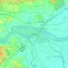
Cuttack
India > Odisha > Cuttack (M.Corp.) P.S
Cuttack is located at 20°31′23″N 085°47′17″E / 20.52306°N 85.78806°E / 20.52306; 85.78806 and has an average elevation of 36 metres (118 ft). The city is spread across an area of 192.5 km2 (74 sq mi). The city, being a Cuttack Municipal Corporation which consists of 59 wards. The city…
Altitude média: 34 m


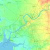
Surat
India > Gujarat > Katargam Taluka > Surat
Surat is a port city situated on the banks of the Tapi river. Damming of the Tapi caused the original port facilities to close; the nearest port is now in the Magadalla and Hazira area of Surat Metropolitan Region.It has famous beach called 'Dumas Beach' located in Hazira. The city is located at 21°10′N…
Altitude média: 11 m


