
Mapa topográfico Haus
Mapa interativo
Clique no mapa para exibir a altitude.
Sobre este mapa
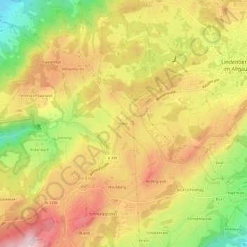
Nome: Mapa topográfico Haus, altitude, relevo.
Local: Haus, Scheidegg, Landkreis Lindau, Bayern, 88175, Deutschland (47.57210 9.83944 47.61210 9.87944)
Altitude média: 773 m
Altitude mínima: 598 m
Altitude máxima: 911 m
Outros mapas topográficos
Clique em um mapa para visualizar sua topografia, sua altitude e seu relevo.
Böserscheidegg
Deutschland > Bayern > Landkreis Lindau > Scheidegg
Böserscheidegg, Scheidegg, Weiler-Simmerberg, Landkreis Lindau, Bayern, 88175, Deutschland
Altitude média: 735 m
Oberschwenden
Deutschland > Bayern > Landkreis Lindau > Scheidegg
Oberschwenden, Scheidegg, Landkreis Lindau, Bayern, 88175, Deutschland
Altitude média: 839 m