
Mapa topográfico Mangaung Ward 45
Mapa interativo
Clique no mapa para exibir a altitude.
Sobre este mapa
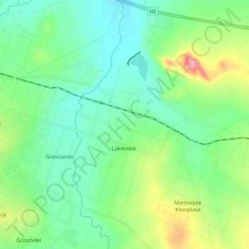
Nome: Mapa topográfico Mangaung Ward 45, altitude, relevo.
Altitude média: 1365 m
Altitude mínima: 1333 m
Altitude máxima: 1438 m
Outros mapas topográficos
Clique em um mapa para visualizar sua topografia, sua altitude e seu relevo.
Mangaung Ward 19
RSA > Free State > Bloemfontein
Mangaung Ward 19, Bloemfontein, Mangaung Metropolitan Municipality, Free State, 9301, RSA
Altitude média: 1407 m
Franklin Game Reserve
RSA > Free State > Bloemfontein
Franklin Game Reserve, Naval Hill 5, Mangaung Ward 21, Bloemfontein, Mangaung Metropolitan Municipality, Free State, 9300, RSA
Altitude média: 1421 m