Geolocalizar

Mapa topográfico La Grande Rivière

Clique no mapa para exibir a altitude.

Sobre este mapa

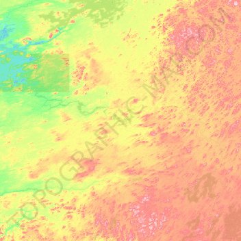
Nome: Mapa topográfico La Grande Rivière, altitude, relevo.

Local: La Grande Rivière, Quebec, Canada (53.21748 -73.46281 53.90080 -70.79041)

Altitude média: 489 m

Altitude mínima: 372 m

Altitude máxima: 730 m

Outros mapas topográficos

Clique em um mapa para visualizar sua topografia, sua altitude e seu relevo.

Quebec

Canada > Quebec > Urban agglomeration of Québec

Quebec City was built on the north bank of the Saint Lawrence River, where it narrows and meets the mouth of the Saint-Charles River. Old Quebec is located on top and at the foot of Cap-Diamant, which is on the eastern edge of a plateau called the promontory of Quebec (Quebec hill). Because of this topographic…

Altitude média: 117 m

Gatineau

Canada > Quebec

Gatineau is located in southwestern Quebec, on the northern bank of the Gatineau River. It is situated at an elevation of around 50 m (164.042 ft) The Gatineau Hills are the foothills of the Laurentian Mountains and located in the region. It is also the location of the second largest urban park in the world.…

Altitude média: 127 m

Shawinigan

Canada > Quebec

Altitude média: 215 m

Quebec

Canada > Quebec > Urban agglomeration of Québec

Quebec City was built on the north bank of the Saint Lawrence River, where it narrows and meets the mouth of the Saint-Charles River. Old Quebec is located on top and at the foot of Cap-Diamant, which is on the eastern edge of a plateau called the promontory of Quebec (Quebec hill). Because of this topographic…

Altitude média: 117 m

Montérégie

Canada > Quebec

Altitude média: 157 m

Deux-Montagnes (MRC)

Canada > Quebec

Altitude média: 49 m

Mauricie

Canada > Quebec

Altitude média: 395 m

Mount Royal

Canada > Quebec > Urban agglomeration of Montreal > Montreal

The hill is part of the Monteregian Hills situated between the Laurentians and the Appalachian Mountains. It gave its Latin name, Mons Regius, to the Monteregian chain. The hill consists of three peaks: Colline de la Croix (or Mont Royal proper) at 233 m (764 ft), Colline d'Outremont (or Mount Murray, in the…

Altitude média: 111 m

Quebec

Canada > Quebec > Urban agglomeration of Québec

Quebec City was built on the north bank of the Saint Lawrence River, where it narrows and meets the mouth of the Saint-Charles River. Old Quebec is located on top and at the foot of Cap-Diamant, which is on the eastern edge of a plateau called the promontory of Quebec (Quebec hill). Because of this topographic…

Altitude média: 100 m

Saguenay

Canada > Quebec > Ville de Saguenay

Altitude média: 150 m

Lachute

Canada > Quebec > Argenteuil

Altitude média: 127 m

Mont-Laurier

Canada > Quebec > Antoine-Labelle

Altitude média: 296 m

Sainte-Adèle

Canada > Quebec > Les Pays-d'en-Haut

Altitude média: 336 m

Sherbrooke

Canada > Quebec

Altitude média: 232 m

Island of Montreal

Canada > Quebec > Montreal

Altitude média: 30 m

Ripon

Canada > Quebec > Papineau

Altitude média: 218 m

Trécesson

Canada > Quebec > Abitibi

Altitude média: 315 m

Mirabel

Canada > Quebec

Altitude média: 71 m

Grenville-sur-la-Rouge

Canada > Quebec > Argenteuil

Altitude média: 188 m

Notre-Dame-des-Bois

Canada > Quebec > Le Granit

Altitude média: 593 m

Lévis

Canada > Quebec

Altitude média: 96 m

Rouyn-Noranda

Canada > Quebec

Altitude média: 307 m

Gaspé Peninsula

Canada > Quebec

Altitude média: 190 m

Manawan

Canada > Quebec

Altitude média: 455 m

Manicouagan

Canada > Quebec

Altitude média: 437 m

Le Rocher-Percé

Canada > Quebec

Altitude média: 147 m

Chelsea

Canada > Quebec > Les Collines-de-l'Outaouais

Altitude média: 166 m

Brome-Missisquoi

Canada > Quebec

Altitude média: 182 m

Anticosti Island

Canada > Quebec

Topographically, Anticosti Island can be divided into three distinct regions: two lowland areas, rarely exceeding 150 metres (490 ft) in elevation, in the eastern and western thirds of the island linked along the coast; and a central highland forming a plateau that rises to just over 300 m (980 ft). This…

Altitude média: 30 m

Abitibi

Canada > Quebec

Altitude média: 314 m

Les Pays-d'en-Haut

Canada > Quebec

Altitude média: 334 m

Saguenay–Lac-Saint-Jean

Canada > Quebec

Altitude média: 449 m

Charlevoix

Canada > Quebec

Altitude média: 593 m

Beauharnois-Salaberry

Canada > Quebec

Altitude média: 44 m

Hull

Canada > Quebec > Gatineau

Altitude média: 66 m

Les Collines-de-l'Outaouais

Canada > Quebec

Altitude média: 177 m

Laval

Canada > Quebec

Altitude média: 41 m

Laurentides

Canada > Quebec

Altitude média: 334 m

Chibougamau

Canada > Quebec

Altitude média: 392 m

Gaspé

Canada > Quebec > La Côte-de-Gaspé > Gaspé

Altitude média: 143 m

Lac-Simon

Canada > Quebec

Altitude média: 321 m

Jamésie

Canada > Quebec

Altitude média: 344 m

Rouyn

Canada > Quebec

Altitude média: 297 m

Rivière Romaine

Canada > Quebec

Altitude média: 479 m

Monts Otish

Canada > Quebec

Altitude média: 924 m

Canton de Cleveland

Canada > Quebec

Altitude média: 209 m

Le Petit Cap

Canada > Quebec

Altitude média: 11 m

Coulonge River

Canada > Quebec

Altitude média: 318 m

Estrie

Canada > Quebec

Altitude média: 348 m

Argenteuil

Canada > Quebec

Altitude média: 189 m

Papineau

Canada > Quebec

Altitude média: 232 m

Saguenay

Canada > Quebec

Altitude média: 268 m

Rivière Péribonka

Canada > Quebec

Altitude média: 487 m

Trois-Rivières

Canada > Quebec

Altitude média: 39 m

Ottawa River (North)

Canada > Quebec

Altitude média: 347 m

Centre-du-Québec

Canada > Quebec

Altitude média: 132 m

L'Île-Saint-Régis

Canada > Quebec

Altitude média: 49 m

Lanaudière

Canada > Quebec

The region of Lanaudière is part of central Quebec and is located between the Saint Lawrence River and the Laurentian Mountains, between Mauricie and the Laurentides. Lanaudière attracts a good deal of interest from vacationers due to its unique character founded largely on the harmony between its culture…

Altitude média: 332 m

Pontiac

Canada > Quebec

Altitude média: 311 m

Montmagny (MRC)

Canada > Quebec

Its territory can be divided into three main geographical areas. The first is constituted of the estuary of the Saint Lawrence River and its islands. Second are the plains, which includes the Saint Lawrence Lowlands, which run from east to west and covers the northern portion of the Montmagny RCM, and is…

Altitude média: 311 m

Bonaventure (MRC)

Canada > Quebec

Altitude média: 230 m

L'Islet (MRC)

Canada > Quebec

Altitude média: 283 m

Antoine-Labelle

Canada > Quebec

Altitude média: 380 m

Avignon

Canada > Quebec

Altitude média: 299 m

L'Assomption (MRC)

Canada > Quebec

Altitude média: 24 m

La Côte-de-Gaspé

Canada > Quebec

Altitude média: 148 m

Portneuf (MRC)

Canada > Quebec

Altitude média: 316 m

Memphrémagog

Canada > Quebec

Altitude média: 292 m

Le Granit

Canada > Quebec

Altitude média: 475 m

La Haute-Gaspésie

Canada > Quebec

Altitude média: 247 m

La Matapédia

Canada > Quebec

Altitude média: 299 m

D'Autray

Canada > Quebec

Altitude média: 166 m

La Haute-Côte-Nord

Canada > Quebec

Altitude média: 348 m

Lac-Saint-Jean-Est

Canada > Quebec

Altitude média: 285 m

Témiscamingue

Canada > Quebec

Altitude média: 318 m

Vaudreuil-Soulanges

Canada > Quebec

Altitude média: 54 m

Chaleur Bay

Canada > Quebec

Altitude média: 102 m

Abitibi-Témiscamingue

Canada > Quebec

Altitude média: 333 m

Prepare-se para a sua próxima aventura:

🪢Fitas de Ancoragem - Segurança e versatilidade
🔋Power Banks Solares Impermeáveis - Carregadores robustos para manter dispositivos ativos em expedições longas
🔨Estojos de Ferramentas de Campo - Organização para bússolas, lupas e ferramentas de marcação
📟Walkie-Talkies de Longo Alcance - Sistemas de comunicação rádio para equipas em zonas sem cobertura móvel
Relógios GPS Outdoor - Monitorização de rotas, altitude e desempenho

Como Associado da Amazon, este site recebe uma comissão sobre compras elegíveis sem custo adicional para si.