
Mapa topográfico Nankai
Mapa interativo
Clique no mapa para exibir a altitude.
Sobre este mapa
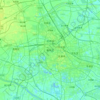
Nome: Mapa topográfico Nankai, altitude, relevo.
Local: Nankai, Nankai District, Tianjin, 300084, China (38.97701 116.98395 39.29701 117.30395)
Altitude média: 5 m
Altitude mínima: -5 m
Altitude máxima: 19 m
Nankai District is located in the south-west corner of the urban Tianjin, bordered by Hongqiao District to the north, Hebei and Heping Districts to the north-east, Hexi District to the east and Xiqing District to the south-west. It occupies an area of 40.64 square kilometres (15.69 sq mi). The natural topography is characterised by higher elevation in the north of the district and a lower elevation in the south, with the average altitude being 3 metres.
Outros mapas topográficos
Clique em um mapa para visualizar sua topografia, sua altitude e seu relevo.