
Mapa topográfico Gorsey Leys
Mapa interativo
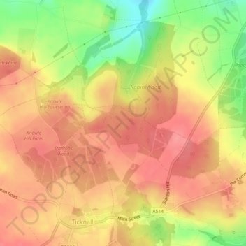
Clique no mapa para exibir a altitude.
Sobre este mapa
Nome: Mapa topográfico Gorsey Leys, altitude, relevo.
Altitude média: 101 m
Altitude mínima: 50 m
Altitude máxima: 128 m
Outros mapas topográficos
Clique em um mapa para visualizar sua topografia, sua altitude e seu relevo.
Robin Wood
United Kingdom > England > Derbyshire > South Derbyshire > Stanton by Bridge CP
Robin Wood, Stanton by Bridge CP, South Derbyshire, Derbyshire, England, United Kingdom
Altitude média: 92 m