
Mapa topográfico Mieres
Mapa interativo
Clique no mapa para exibir a altitude.
Sobre este mapa
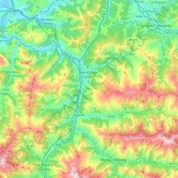
Nome: Mapa topográfico Mieres, altitude, relevo.
Local: Mieres, Asturias, Spain (43.18111 -5.85553 43.28914 -5.62549)
Altitude média: 498 m
Altitude mínima: 116 m
Altitude máxima: 1171 m
Mieres is the heart of the coal mining industry in Spain. The topography of Mieres is mountainous with the greatest population centers being located in the valley along the banks of the Caudal River (Río Caudal) valley in the center of Asturias. Before the Spanish Industrial Restructuring Mieres was one of the industrial backbones of Asturias, and hosted 70000 inhabitants in the 1960s. Today Mieres shelters a campus of the University of Oviedo and different museums in relation with the industrial heritage.