
Mapa topográfico Vucht
Mapa interativo
Clique no mapa para exibir a altitude.
Sobre este mapa
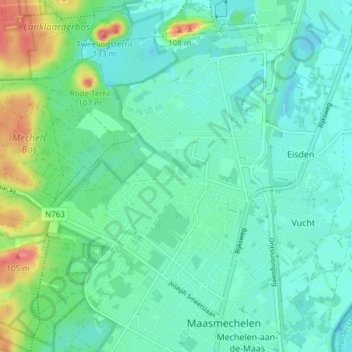
Nome: Mapa topográfico Vucht, altitude, relevo.
Local: Vucht, Maasmechelen, Tongeren, Limburg, Vlaanderen, België (50.96877 5.66020 50.99782 5.73544)
Altitude média: 47 m
Altitude mínima: 30 m
Altitude máxima: 100 m
Outros mapas topográficos
Clique em um mapa para visualizar sua topografia, sua altitude e seu relevo.
Uikhoven
België > Vlaanderen > Maasmechelen
Uikhoven, Maasmechelen, Tongeren, Limburg, Vlaanderen, 3631, België
Altitude média: 42 m