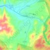
Mapa topográfico Tabernash
Clique no mapa para exibir a altitude.
Tabernash
On August 10, 1984, a Cessna L-19 Bird Dog (registration N4584A), piloted by James Jeb Caddell, 36, crashed in a forest near Tabernash. The aircraft was en route from Granby to Jeffco Airport, Colorado. The wreckage was found by backpackers three years later on August 23, 1987. A 6½ minute video shot from a VHS camcorder mounted on the instrument panel was found at the site. The heavily damaged tape, some of it hanging from tree branches, was recovered and repaired by Colorado deputy sheriff Dale Wood. Subsequent analysis of the footage revealed that the pilot had not taken into account the density altitude conditions that existed on the day of the flight. The aircraft was unable to climb away from steadily rising terrain. In an attempt to return to the departure airfield, the pneumatic stall warning of the airplane sounded three times during a turn to the right. The pilot could be heard yelling, "Damn, hang on Ronnie!" to his one backseat passenger, Ronald Hugh Wilmond, 36, three seconds before impacting the terrain and trees.
Sobre este mapa
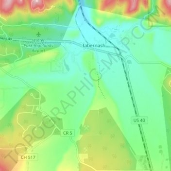
Nome: Mapa topográfico Tabernash, altitude, relevo.
Local: Tabernash, Grand County, Colorado, United States (39.95541 -105.87197 40.00724 -105.82038)
Altitude média: 2593 m
Altitude mínima: 2523 m
Altitude máxima: 2749 m
Outros mapas topográficos
Clique em um mapa para visualizar sua topografia, sua altitude e seu relevo.
Winter Park
United States > Colorado > Grand County
Its elevation ranges from approximately 8,700 to 12,060 feet (2,650 to 3,680 m) above sea level, and is considered sub-alpine country. It is snow-covered for about six months a year. Although the town center is at about 9,000 feet (2,700 m) above sea level, Winter Park, using administrative boundaries as a…
Altitude média: 3061 m
Winter Park
United States > Colorado > Grand County
Its elevation ranges from approximately 8,700 to 12,060 feet (2,650 to 3,680 m) above sea level, and is considered sub-alpine country. It is snow-covered for about six months a year. Although the town center is at about 9,000 feet (2,700 m) above sea level, Winter Park, using administrative boundaries as a…
Altitude média: 3061 m