
Mapa topográfico Southern Alps / Kā Tiritiri o te Moana
Mapa interativo
Clique no mapa para exibir a altitude.
Sobre este mapa
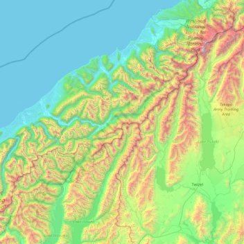
Nome: Mapa topográfico Southern Alps / Kā Tiritiri o te Moana, altitude, relevo.
Altitude média: 771 m
Altitude mínima: -1 m
Altitude máxima: 3708 m
The Southern Alps / Kā Tiritiri o te Moana is a mountain range extending along much of the length of New Zealand's South Island, reaching its greatest elevations near the range's western side. The name "Southern Alps" generally refers to the entire range, although separate names are given to many of the smaller ranges that form part of it.