
Mapa topográfico Methana
Mapa interativo
Clique no mapa para exibir a altitude.
Sobre este mapa
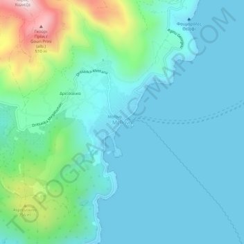
Nome: Mapa topográfico Methana, altitude, relevo.
Altitude média: 123 m
Altitude mínima: -2 m
Altitude máxima: 667 m
Since 1991, the peninsula has been investigated by the team of ETH Zürich geologically and cartographically. From this, a topographical map of the entire peninsula at a scale of 1:25,000 was made. An interactive 3D map was created and is on the World Wide Web. Also a rich photographic archive with about 10.000 color slides has been produced (see links below).