
Mapa topográfico Tideswell Dale
Mapa interativo
Clique no mapa para exibir a altitude.
Sobre este mapa
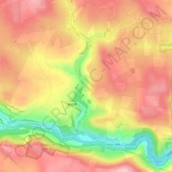
Nome: Mapa topográfico Tideswell Dale, altitude, relevo.
Altitude média: 292 m
Altitude mínima: 187 m
Altitude máxima: 353 m
Outros mapas topográficos
Clique em um mapa para visualizar sua topografia, sua altitude e seu relevo.
Cressbrook Dale
United Kingdom > England > Derbyshire > Derbyshire Dales > Litton CP > Litton Mill
Cressbrook Dale, Litton Mill, Litton CP, Cressbrook, Derbyshire Dales, Derbyshire, England, SK17 8ST, United Kingdom
Altitude média: 286 m