
Mapa topográfico Haselbach
Mapa interativo
Clique no mapa para exibir a altitude.
Sobre este mapa
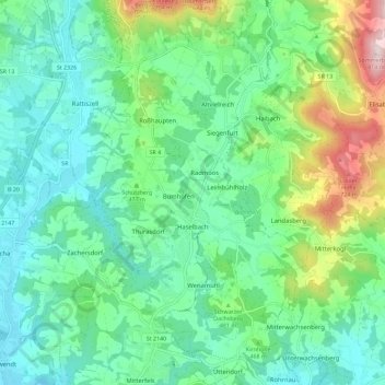
Nome: Mapa topográfico Haselbach, altitude, relevo.
Altitude média: 448 m
Altitude mínima: 326 m
Altitude máxima: 803 m
Outros mapas topográficos
Clique em um mapa para visualizar sua topografia, sua altitude e seu relevo.
Falkenfels
Duitsland > Beieren > Landkreis Straubing-Bogen
Falkenfels, Mitterfels (VGem), Landkreis Straubing-Bogen, Beieren, 94350, Duitsland
Altitude média: 449 m
Leiblfing
Duitsland > Beieren > Landkreis Straubing-Bogen
Leiblfing, Landkreis Straubing-Bogen, Beieren, 94339, Duitsland
Altitude média: 396 m
Sankt Englmar
Duitsland > Beieren > Landkreis Straubing-Bogen
Sankt Englmar, Landkreis Straubing-Bogen, Beieren, 94379, Duitsland
Altitude média: 712 m