
Mapa topográfico Bowmansville
Mapa interativo
Clique no mapa para exibir a altitude.
Sobre este mapa
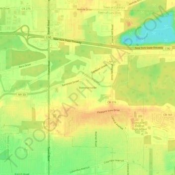
Nome: Mapa topográfico Bowmansville, altitude, relevo.
Altitude média: 215 m
Altitude mínima: 193 m
Altitude máxima: 227 m
Outros mapas topográficos
Clique em um mapa para visualizar sua topografia, sua altitude e seu relevo.
East Lancaster
United States > New York > Erie County > Town of Lancaster
East Lancaster, Town of Lancaster, Erie County, New York, 14086, United States
Altitude média: 216 m
Village of Depew
United States > New York > Erie County > Town of Lancaster
Village of Depew, Town of Lancaster, Erie County, New York, 14043, United States
Altitude média: 208 m
Lancaster
United States > New York > Erie County > Town of Lancaster
Lancaster, Town of Lancaster, Erie County, New York, United States
Altitude média: 224 m