
Mapa topográfico Roopkund Lake
Mapa interativo
Clique no mapa para exibir a altitude.
Sobre este mapa
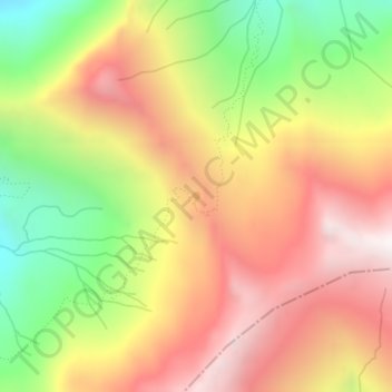
Nome: Mapa topográfico Roopkund Lake, altitude, relevo.
Altitude média: 4631 m
Altitude mínima: 3974 m
Altitude máxima: 5200 m
Roopkund (locally known as Mystery Lake or Skeleton Lake) is a high altitude glacial lake in the Uttarakhand state of India. It lies in the lap of Trishul massif. Located in the Himalayas, the area around the lake is uninhabited and is roughly at an altitude of 5,020 metres (16,470 ft), surrounded by rock-strewn glaciers and snow-clad mountains. Roopkund is a popular trekking destination. The size of the lake varies substantially, but it is seldom more than 40 metres in diameter (1000 to 1500 square metres in area), and is frozen in the winter.