
Mapa topográfico Strathcona Science Provincial Park
Mapa interativo
Clique no mapa para exibir a altitude.
Sobre este mapa
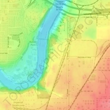
Nome: Mapa topográfico Strathcona Science Provincial Park, altitude, relevo.
Altitude média: 653 m
Altitude mínima: 608 m
Altitude máxima: 691 m
The park is situated in the North Saskatchewan River valley, on both banks of the river, at an elevation of 625 m (2,051 ft) and has a surface of 2.9 km2 (1.1 sq mi). It was established on December 12, 1979 and is maintained by Alberta Tourism, Parks and Recreation.
Outros mapas topográficos
Clique em um mapa para visualizar sua topografia, sua altitude e seu relevo.
Sherwood Park
Canada > Alberta > Strathcona County > Sherwood Park
Sherwood Park, Strathcona County, Alberta, Canada
Altitude média: 691 m