
Mapa topográfico Walker Fold
Mapa interativo
Clique no mapa para exibir a altitude.
Sobre este mapa
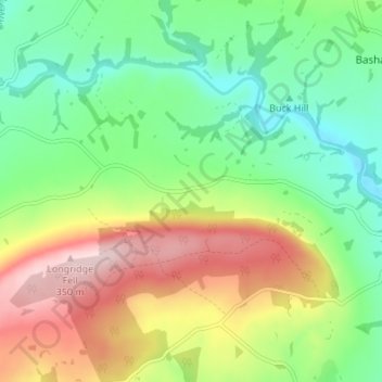
Nome: Mapa topográfico Walker Fold, altitude, relevo.
Altitude média: 170 m
Altitude mínima: 60 m
Altitude máxima: 343 m
Outros mapas topográficos
Clique em um mapa para visualizar sua topografia, sua altitude e seu relevo.
Sabden
Vereinigtes Königreich > England > Lancashire > Ribble Valley
Sabden, Ribble Valley, Lancashire, England, Vereinigtes Königreich
Altitude média: 236 m
Thornley-with-Wheatley
Vereinigtes Königreich > England > Lancashire > Ribble Valley
Thornley-with-Wheatley, Ribble Valley, Lancashire, England, Vereinigtes Königreich
Altitude média: 150 m