
Mapa topográfico Fox Creek
Mapa interativo
Clique no mapa para exibir a altitude.
Fox Creek
Fox Creek is a town in northwest Alberta, Canada. It is located on Highway 43, approximately 259 km (161 mi) northwest of Edmonton and 199 km (124 mi) southeast of Grande Prairie, and has an elevation of 808 m (2,651 ft).
Sobre este mapa
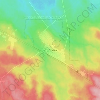
Nome: Mapa topográfico Fox Creek, altitude, relevo.
Local: Fox Creek, Town of Fox Creek, Alberta, T0H 1P0, Canada (54.35721 -116.84338 54.43721 -116.76338)
Altitude média: 834 m
Altitude mínima: 776 m
Altitude máxima: 913 m