
Mapa topográfico Telegraph Woods
Mapa interativo
Clique no mapa para exibir a altitude.
Sobre este mapa
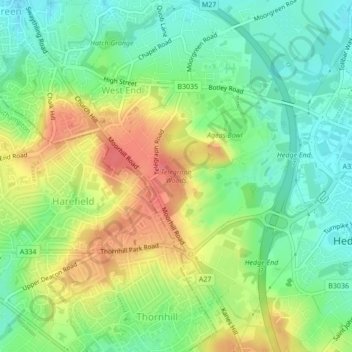
Nome: Mapa topográfico Telegraph Woods, altitude, relevo.
Altitude média: 50 m
Altitude mínima: 23 m
Altitude máxima: 87 m
Outros mapas topográficos
Clique em um mapa para visualizar sua topografia, sua altitude e seu relevo.
West End Copse
United Kingdom > England > Hampshire > Eastleigh > West End
West End Copse, Chartwell Green, West End, Eastleigh, Hampshire, England, United Kingdom
Altitude média: 39 m
Hatch Grange
United Kingdom > England > Hampshire > Eastleigh > West End
Hatch Grange, West End, Eastleigh, Hampshire, England, United Kingdom
Altitude média: 39 m