
Mapa topográfico Tullahoma
Mapa interativo
Clique no mapa para exibir a altitude.
Sobre este mapa
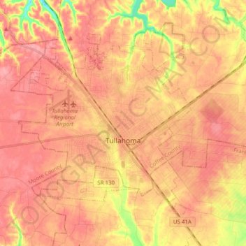
Nome: Mapa topográfico Tullahoma, altitude, relevo.
Altitude média: 323 m
Altitude mínima: 263 m
Altitude máxima: 349 m
Tullahoma is located in the southwest corner of Coffee County at 35°22′7″N 86°12′48″W / 35.36861°N 86.21333°W / 35.36861; -86.21333 (35.368511, -86.213258), and extends south into Franklin County. It is situated at the edge of the Highland Rim, with flatter topography than in the surrounding area. The region was known as "the Barrens" to the first settlers.
Outros mapas topográficos
Clique em um mapa para visualizar sua topografia, sua altitude e seu relevo.
Hillsboro
United States > Tennessee > Coffee County
Hillsboro, Coffee County, Middle Tennessee, Tennessee, 37342, United States
Altitude média: 323 m
Coffee County
United States > Tennessee > Coffee County
Coffee County, Tennessee, United States
Altitude média: 333 m