
Mapa topográfico Bridgewater
Mapa interativo
Clique no mapa para exibir a altitude.
Bridgewater
According to the United States Census Bureau, the town has a total area of 2.52 sq mi (6.5 km2), nearly all of it being land. Most of the town is located within a bend of the North River. Floods have wrecked the town occasionally. The northern areas are partly shielded from flooding with an Army Corps of Engineers dam. The wooded monadnock called Round Hill (elevation approx. 1750 feet) dominates the town's western skyline.
Sobre este mapa
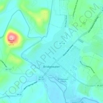
Nome: Mapa topográfico Bridgewater, altitude, relevo.
Local: Bridgewater, Rockingham County, Virginia, United States (38.36928 -78.98997 38.40543 -78.94621)
Altitude média: 380 m
Altitude mínima: 351 m
Altitude máxima: 515 m
Outros mapas topográficos
Clique em um mapa para visualizar sua topografia, sua altitude e seu relevo.