
Mapa topográfico Daporijo
Mapa interativo
Clique no mapa para exibir a altitude.
Sobre este mapa
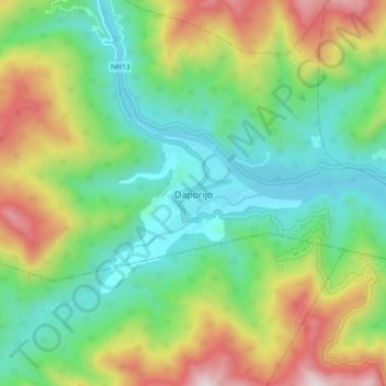
Nome: Mapa topográfico Daporijo, altitude, relevo.
Altitude média: 541 m
Altitude mínima: 216 m
Altitude máxima: 1171 m
Daporijo is located at an elevation of 600 m above sea level. It is located beside the river Subansiri, one of the principal rivers of Arunachal Pradesh, and a major tributary of the mighty Brahmaputra Daporijo valley is surrounded by Evergreen hills in three corners and Subansiri river in the other.