
Mapa topográfico Silao
Mapa interativo
Clique no mapa para exibir a altitude.
Sobre este mapa
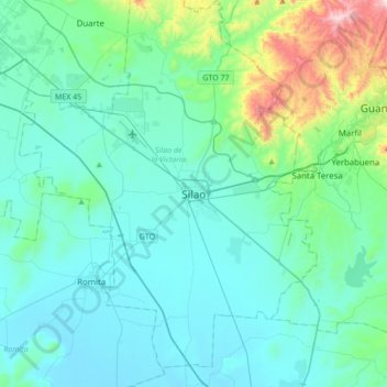
Nome: Mapa topográfico Silao, altitude, relevo.
Altitude média: 1877 m
Altitude mínima: 1735 m
Altitude máxima: 2705 m
The territory of Silao is almost planar formed in by the Bajío, between its few important elevations, one can find the 'Cerro del Cubilete' whose altitude is 2,570 meters above sea level and is considered the geographic center of the country.