
Mapa topográfico St. John's Beck
Mapa interativo
Clique no mapa para exibir a altitude.
Sobre este mapa
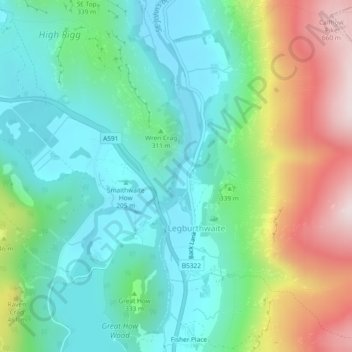
Nome: Mapa topográfico St. John's Beck, altitude, relevo.
Altitude média: 311 m
Altitude mínima: 148 m
Altitude máxima: 677 m
Outros mapas topográficos
Clique em um mapa para visualizar sua topografia, sua altitude e seu relevo.
St. John's in the Vale
United Kingdom > England > Cumberland > Legburthwaite
St. John's in the Vale, St. John's Castlerigg and Wythburn, Legburthwaite, Cumberland, England, United Kingdom
Altitude média: 256 m