
Mapa topográfico Bardhaman
Mapa interativo
Clique no mapa para exibir a altitude.
Bardhaman
The region has an average elevation of 40 metres (131 ft). The city is situated 1100 km from New Delhi and a little less than 100 km north-west of Kolkata on the Grand Trunk Road (National Highway 19) and Eastern Railway. The chief rivers are the Damodar and the Banka.
Sobre este mapa
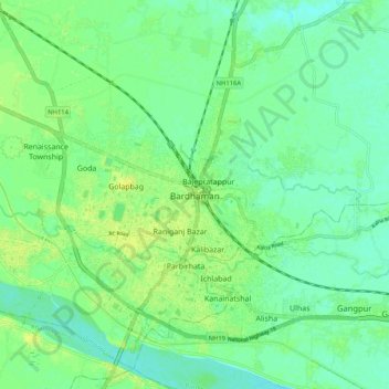
Nome: Mapa topográfico Bardhaman, altitude, relevo.
Altitude média: 31 m
Altitude mínima: 23 m
Altitude máxima: 40 m