
Mapa topográfico Kharagpur
Mapa interativo
Clique no mapa para exibir a altitude.
Sobre este mapa
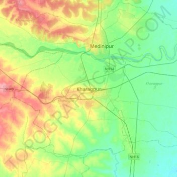
Nome: Mapa topográfico Kharagpur, altitude, relevo.
Altitude média: 39 m
Altitude mínima: 12 m
Altitude máxima: 88 m
Kharagpur is the fourth largest city of West Bengal in area after Kolkata, Durgapur and Asansol. It is also the fifth most populated city of West Bengal after Kolkata, Asansol, Siliguri, Durgapur - located at 22°19′49″N 87°19′25″E / 22.330239°N 87.323653°E / 22.330239; 87.323653, covering an area of about 127 km2 in southern part of West Midnapore. It has an average elevation of 29 metres (95 ft). This sub-division town is formed with Dalma Pahar and alluvial tract of Midnapore. It is intersected by numerous waterways, the important rivers being Subarnarekha, Keleghai and Kangsabati.