
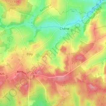
Mapa topográfico Vaux-lez-Chêne
Mapa interativo
Clique no mapa para exibir a altitude.
Sobre este mapa
Nome: Mapa topográfico Vaux-lez-Chêne, altitude, relevo.
Altitude média: 470 m
Altitude mínima: 415 m
Altitude máxima: 517 m
Outros mapas topográficos
Clique em um mapa para visualizar sua topografia, sua altitude e seu relevo.
Ebly
Belgique > Luxembourg > Neufchâteau > Ebly
Ebly, Léglise, Neufchâteau, Luxembourg, Wallonie, Belgique
Altitude média: 470 m
Maisoncelle
Belgique > Luxembourg > Neufchâteau > Ebly > Maisoncelle
Maisoncelle, Ebly, Léglise, Neufchâteau, Luxembourg, Wallonie, 6642, Belgique
Altitude média: 474 m