
Mapa topográfico Village of Cayuga Heights
Mapa interativo
Clique no mapa para exibir a altitude.
Sobre este mapa
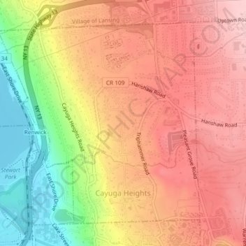
Nome: Mapa topográfico Village of Cayuga Heights, altitude, relevo.
Altitude média: 234 m
Altitude mínima: 114 m
Altitude máxima: 311 m
Cayuga Heights is located at 42°27′59″N 76°29′19″W / 42.466338°N 76.488678°W / 42.466338; -76.488678 (42.466338, -76.488678), on the eastern slope of Cayuga Lake. The elevation ranges from 900 feet near the Community Corners to 400 feet near the lake. Several streams and steep gorges cut through the village.