
Mapa topográfico Kellow Lake
Mapa interativo
Clique no mapa para exibir a altitude.
Sobre este mapa
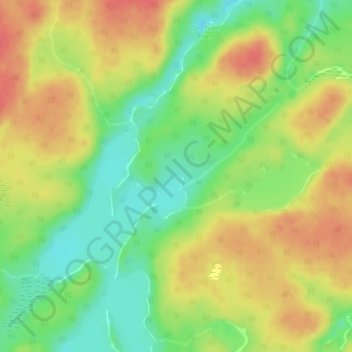
Nome: Mapa topográfico Kellow Lake, altitude, relevo.
Altitude média: 294 m
Altitude mínima: 264 m
Altitude máxima: 321 m
Outros mapas topográficos
Clique em um mapa para visualizar sua topografia, sua altitude e seu relevo.
Camp 36 Lake
Canada > Ontario > Thunder Bay District > Unorganized Thunder Bay District
Camp 36 Lake, Unorganized Thunder Bay District, Thunder Bay District, Northwestern Ontario, Ontario, Canada
Altitude média: 269 m