
Mapa topográfico Ruidenberg
Mapa interativo
Clique no mapa para exibir a altitude.
Sobre este mapa
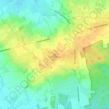
Nome: Mapa topográfico Ruidenberg, altitude, relevo.
Altitude média: 33 m
Altitude mínima: 15 m
Altitude máxima: 54 m
Outros mapas topográficos
Clique em um mapa para visualizar sua topografia, sua altitude e seu relevo.
Ichtegem
België > West-Vlaanderen > Oostende > Ichtegem
Ichtegem, Oostende, West-Vlaanderen, Vlaanderen, 8480, België
Altitude média: 23 m