Mapa topográfico Lathkill Dale
Mapa interativo
Clique no mapa para exibir a altitude.
Sobre este mapa
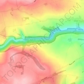
Nome: Mapa topográfico Lathkill Dale, altitude, relevo.
Altitude média: 269 m
Altitude mínima: 172 m
Altitude máxima: 330 m

Clique no mapa para exibir a altitude.
Nome: Mapa topográfico Lathkill Dale, altitude, relevo.
Altitude média: 269 m
Altitude mínima: 172 m
Altitude máxima: 330 m