
Mapa topográfico Uturuncu
Mapa interativo
Clique no mapa para exibir a altitude.
Sobre este mapa
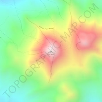
Nome: Mapa topográfico Uturuncu, altitude, relevo.
Altitude média: 5594 m
Altitude mínima: 5259 m
Altitude máxima: 6006 m
At an elevation of 6,008 metres (19,711 ft), Uturuncu is the highest mountain in southwestern Bolivia. It dominates the regional geomorphology, rising about 1,510–1,670 metres (4,950–5,480 ft) above the surrounding terrain and presenting a good view of the surrounding mountains from the summit. The volcano has two summit peaks, one 5,930 metres (19,460 ft) and the other 6,008 metres (19,711 ft) high. They are about 1 kilometre (0.62 mi) apart and separated by a saddle that is 5,700 metres (18,700 ft) high. Uturuncu is a stratovolcano with remnants of a crater, and consists of lava domes and lava flows erupted from a number of vents in the central part of the volcano.