
Mapa topográfico Ledrosee
Mapa interativo
Clique no mapa para exibir a altitude.
Sobre este mapa
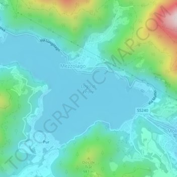
Nome: Mapa topográfico Ledrosee, altitude, relevo.
Altitude média: 768 m
Altitude mínima: 643 m
Altitude máxima: 1290 m
Der Lago di Ledro liegt auf 655 m s.l.m. Höhe zwischen dem Gardasee und dem Idrosee am Ostende des Valle di Ledro. Der See hat eine Fläche von 2,187 km². Die tiefste Stelle liegt 47 m unter der Wasseroberfläche.