
Mapa topográfico Hume Lake
Mapa interativo
Clique no mapa para exibir a altitude.
Hume Lake
The surface elevation of the lake is 1,586.34 m (5,204.5 ft). It is accessible from California Route 180, via Forest Service road 30, and is about 51 mi (82 km) east of Fresno, not far from the west entrance to Kings Canyon National Park.
Sobre este mapa
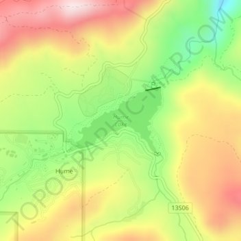
Nome: Mapa topográfico Hume Lake, altitude, relevo.
Local: Hume Lake, Hume, Fresno County, California, United States (36.78691 -118.91295 36.79437 -118.90006)
Altitude média: 1661 m
Altitude mínima: 1427 m
Altitude máxima: 1887 m