
Mapa topográfico Bowron Lake Provincial Park
Mapa interativo
Clique no mapa para exibir a altitude.
Sobre este mapa
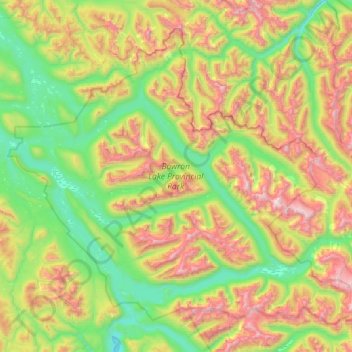
Nome: Mapa topográfico Bowron Lake Provincial Park, altitude, relevo.
Altitude média: 1444 m
Altitude mínima: 818 m
Altitude máxima: 2657 m
Bears are quite common in the park – black bears are numerous in the lower altitudes around the lake, and grizzly bears frequent the alpine areas. In addition to its bears, Bowron Lake Park is home to predators like cougars, wolves, wolverines, and lynx.