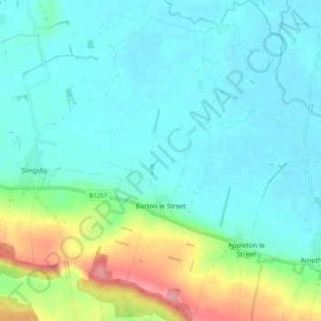
Mapa topográfico Barton-le-Street
Mapa interativo
Clique no mapa para exibir a altitude.
Sobre este mapa
Nome: Mapa topográfico Barton-le-Street, altitude, relevo.
Altitude média: 43 m
Altitude mínima: 20 m
Altitude máxima: 120 m

Clique no mapa para exibir a altitude.
Nome: Mapa topográfico Barton-le-Street, altitude, relevo.
Altitude média: 43 m
Altitude mínima: 20 m
Altitude máxima: 120 m