
Mapa topográfico South Sioux City
Mapa interativo
Clique no mapa para exibir a altitude.
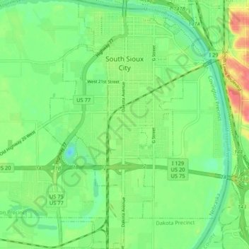
South Sioux City
In contrast to its hilly larger neighbor, South Sioux City is relatively flat. The difference in elevation across most of the city is less than 20 feet, generally ranging between 1,085 and 1,105 feet above sea level.
Sobre este mapa
Nome: Mapa topográfico South Sioux City, altitude, relevo.
Altitude média: 335 m
Altitude mínima: 311 m
Altitude máxima: 376 m