
Mapa topográfico Rustenburg
Mapa interativo
Clique no mapa para exibir a altitude.
Rustenburg
Rustenburg has a humid subtropical climate (Köppen Cwa), with a relatively high degree of diurnal temperature variation due to the high elevation. It has very warm summers (from December to February) and mild winters (from June to August). Due to the altitude, summers are not quite as hot as one might expect. Precipitation occurs mainly in summer. There is occasional frost at night in winter.
Sobre este mapa
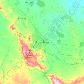
Nome: Mapa topográfico Rustenburg, altitude, relevo.
Altitude média: 1217 m
Altitude mínima: 1028 m
Altitude máxima: 1756 m