
Mapa topográfico Chellala
Mapa interativo
Clique no mapa para exibir a altitude.
Sobre este mapa
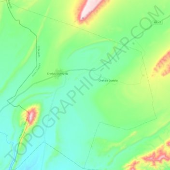
Nome: Mapa topográfico Chellala, altitude, relevo.
Local: Chellala, daïra Chellala, El Bayadh, Algérie (32.92140 -0.01713 33.11444 0.18642)
Altitude média: 1156 m
Altitude mínima: 1008 m
Altitude máxima: 1621 m
Outros mapas topográficos
Clique em um mapa para visualizar sua topografia, sua altitude e seu relevo.
El Mehara
Algérie > El Bayadh > daïra Chellala
El Mehara, daïra Chellala, El Bayadh, 32002, Algérie
Altitude média: 1194 m
Chellala Dahrania
Algérie > El Bayadh > daïra Chellala > Chellala
Chellala Dahrania, Chellala, daïra Chellala, El Bayadh, Algérie
Altitude média: 1132 m