
Mapa topográfico Golestan National Park
Mapa interativo
Clique no mapa para exibir a altitude.
Golestan National Park
The park is located in the eastern Alborz (Elburs) Mountains range and the western edge of the Kopet Dag range. It comprises 91,890 ha. Elevations in the park range from 1,000–1,400 metres (3,300–4,600 ft) above sea level.
Sobre este mapa
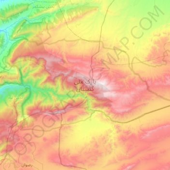
Nome: Mapa topográfico Golestan National Park, altitude, relevo.
Altitude média: 1248 m
Altitude mínima: 315 m
Altitude máxima: 2337 m