
Mapa topográfico Blue Knob
Mapa interativo
Clique no mapa para exibir a altitude.
Sobre este mapa
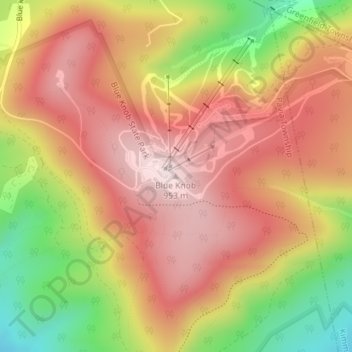
Nome: Mapa topográfico Blue Knob, altitude, relevo.
Altitude média: 792 m
Altitude mínima: 546 m
Altitude máxima: 957 m
Blue Knob (elevation 3,146 feet (959 m)) is a summit in the eastern United States with a broad dome that is the northernmost 3,000-footer in the Allegheny Mountains. It is the highest point in Bedford County, Pennsylvania.