
Mapa topográfico Tirupattur
Mapa interativo
Clique no mapa para exibir a altitude.
Tirupattur
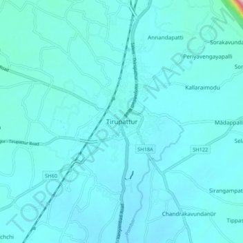
Tirupathur is called "Sandalwood Town" due to the abundance of sandalwood trees in the surrounding hills. It is very close to the Yelagiri hills, a major hill station of Tamil Nadu. The town is at an average elevation of 388 m (1,273 ft). The Jawadhu Hills, a part of the eastern ghats, are to the east of Tirupathur. The major group of soils found in the town are black (10 percent) and red (90 varieties). Tirupathur town has 56.059 km (34.833 mi) of roads.
Sobre este mapa
Nome: Mapa topográfico Tirupattur, altitude, relevo.
Local: Tirupattur, Tirupathur, Tirupattur, Tamil Nadu, 635600, India (12.45090 78.52471 12.53090 78.60471)
Altitude média: 389 m
Altitude mínima: 364 m
Altitude máxima: 726 m